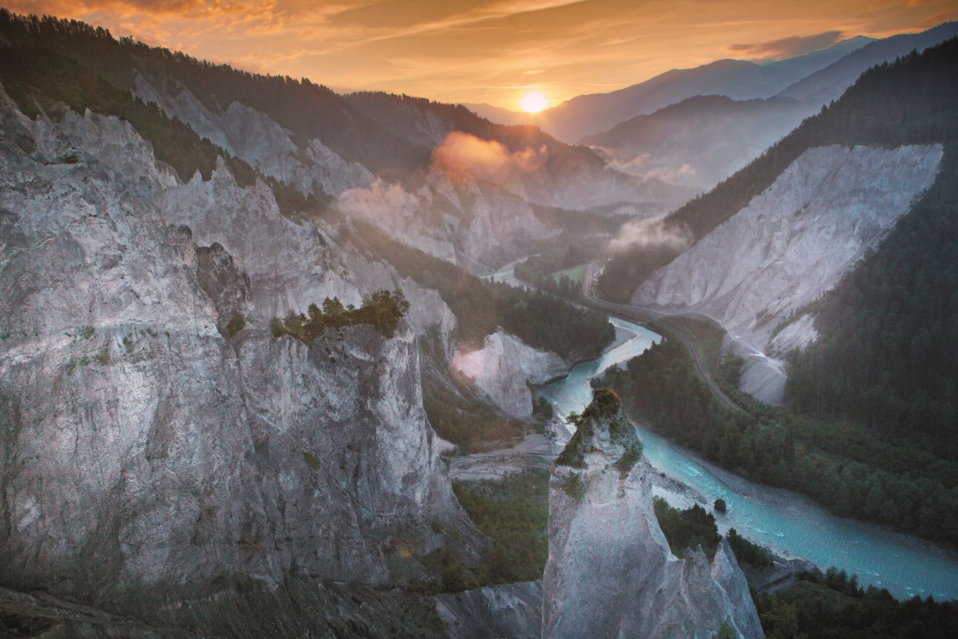
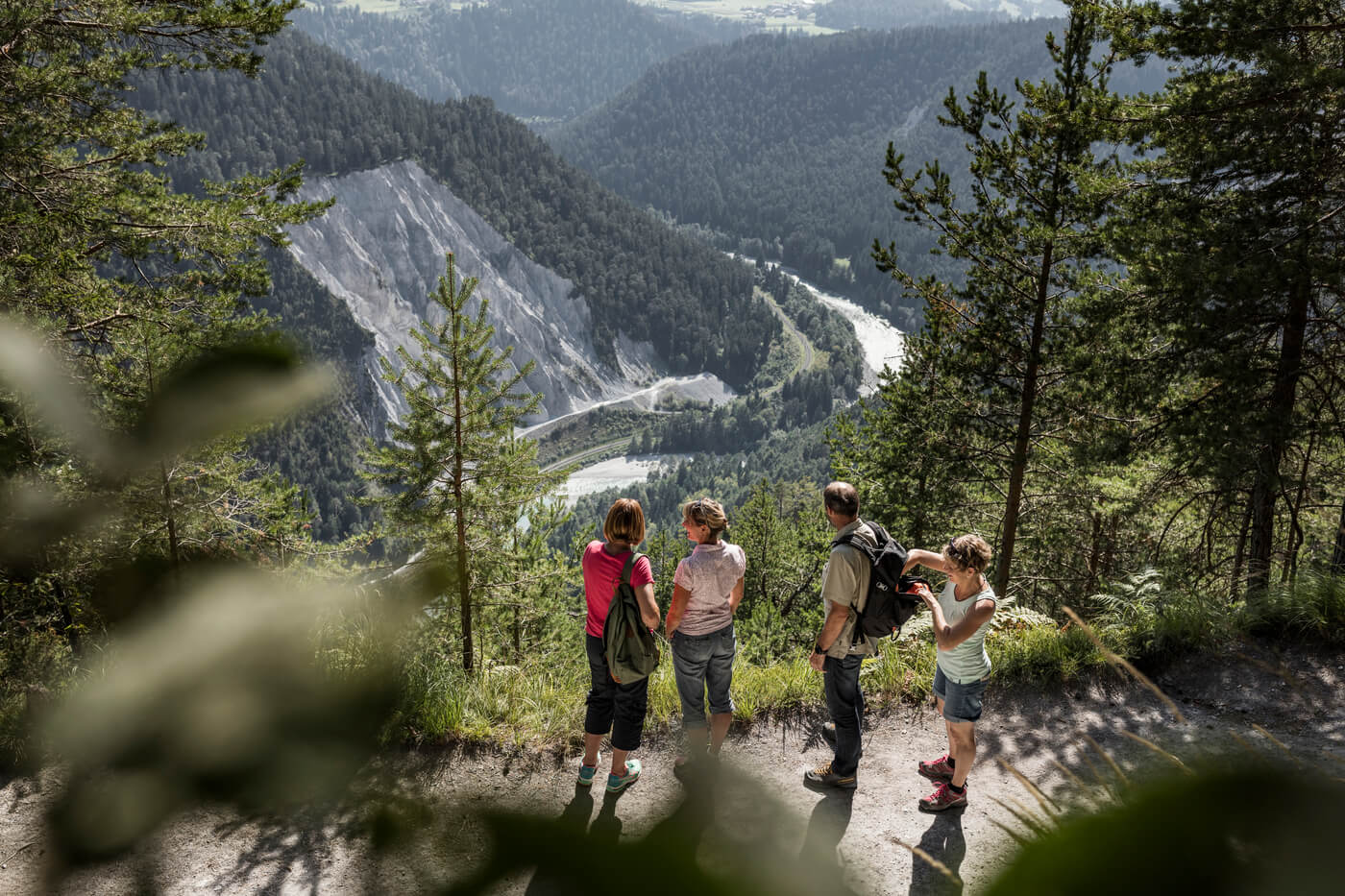
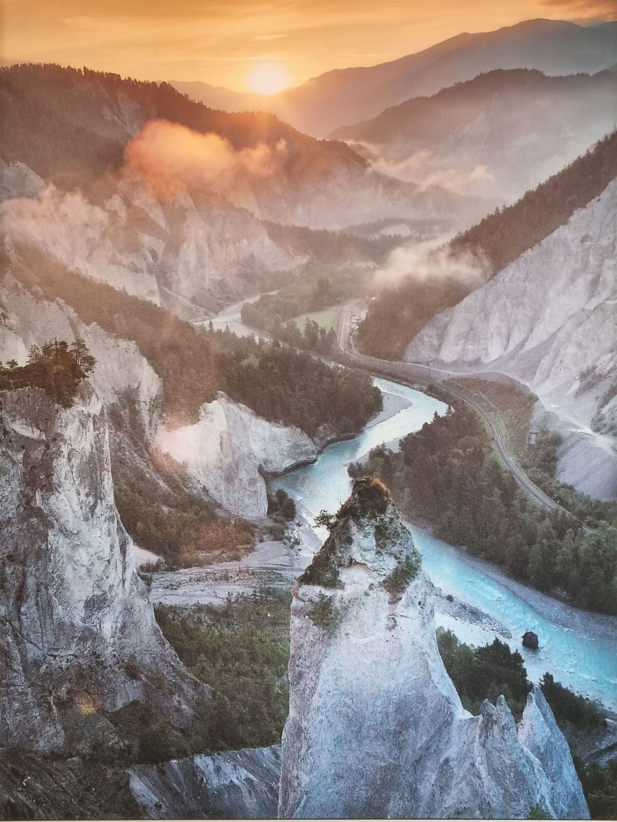
The mega event Flims landslide
Just under 10,000 years ago, over 25 million tons of limestone collapsed above Flims, between the mountains Flimserstein and Piz Grisch. They dropped more than 1,000 meters and buried the valley of the Vorder Rhine between the current villages of Castrisch and Reichenau over an area of more than 50 km2 under a huge bulk of debris several hundred meters thick.
There are various causes for this natural disaster. Tectonics and the quality of the rocks probably played a role. During the formation of the Alps, individual layers of rock were exposed to enormous loading.
The main releasing factors might have been above all the decline of the glaciers, erosion of the valley bottoms and changing climatic conditions.
As long as a glacier occupies the valley, it binds the mountainside. However, a slope becomes completely unbalanced when the glacier declines and at the same time the valley bottom is heavily eroded by snowmelt. The Flims landslide took place several thousand years after the decline of the Rhine- and the Segnes glacier. Climatically, this period was influenced by strong variations in temperature between summer and winter as well as momentary cold and moist phases. It is possible that the permafrost thawed, which – linked to increased precipitation – contributed to further destabilization of the slopes.
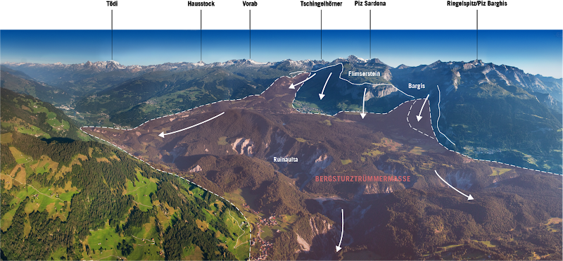
The Flims landslide is the largest postglacial landslide in the whole Alps. The rubble material consists mainly of Quinter limestone. There are limestone blocks of all dimensions, from the size of a house to almost powdery crushed rocks.
Due to the tremendous rock mass from the Flims landslide, the Vorder Rhine could no longer flow down to Lake Constance and banked to a lake. Lake Ilanz was dammed up over a length of around 29 km and persisted for a maximum of 100 years until a catastrophic lake eruption happened. The imprints of which can be traced throughout the entire Rhine Valley and into Lake Constance. The eruption also burst the Tamins landslide. The Rhine dammed up again to a height of approx. 820 m above sea level. This lake lasted for around 1000 years. Its dam was degraded by continuous erosion; the Rhine carved deep into the masses of the landslide. Today its riverbed lies at approx. 620 m above sea level, creating the unique landscape of the Rhine Gorge.
Terraviva